 Catálogo IDEAndalucia
REDIAM. WMS Mapa Geomorfológico de Andalucía
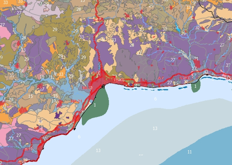
Servicio WMS correspondiente al Mapa Geomorfológico elaborado a partir del Atlas de Andalucía (tomo II) por la Consejería de Obras Públicas y Transportes y la Consejería de Medio Ambiente a escala 1:400.000. Desarrollado en base al Mapa Geológico de la serie Magna 1:50.000, ajustado con imágenes de satélite Landsat. En el medio terrestre se han establecido 12 Sistemas Morfogenéticos, 3 en el Dominio marino-continental (litoral, estuarino y eólico), y 8 en el continental (fluvial, lacustre, fluvio-gravitacional, denudativo, estructural-denudativo, glaciar-periglaciar, kárstico-denudativo y volcánico-denudativo). También se ha definido una clase, formas antrópicas, que se encuentra presente tanto en el Dominio marino-continental como en el continental propiamente dicho y que atiende, más que a criterios geomorfológicos, a su génesis artificial. En el medio marino se definen las siguientes formas y procesos geomorfológicos: formas de plataforma, forma de talud y cuencas marinas, y procesos (aporte sedimentario al talud, deslizamientos, avance y retroceso de línea de costa y transferencia de sedimentos). Predomina el análisis de tipo fisiográfico. Nodo de la Red de Información Ambiental de Andalucía. Junta de Andalucía. Integrado en la Infraestructura de Datos Espaciales de Andalucía, siguiendo las directrices del Sistema Cartográfico de Andalucía.
Simple
- Date (Revision)
- 2012-12-18T13:48:02
- Status
- Completed
- Point of contact
-
Organisation name Individual name Electronic mail address Role Consejería de Medio Ambiente y Ordenación del Territorio. Junta de Andalucía
--
Point of contact
-
Registro de temas REDIAM
-
-
Litoral
-
- Theme
-
-
WMS
-
servidor de mapas en red
-
Andalucía
-
Medio Ambiente
-
Geomorfología
-
humanInteractionService
-
IDEAndalucia
-
- Use limitation
-
Este servicio se puede usar de modo libre y gratuito siempre que se mencione a los autores y propietarios de la información
- Access constraints
- Other restrictions
- Use constraints
- Other restrictions
- Other constraints
-
Creative Commons Reconocimiento 4.0 (CC BY 4.0)
- Service Type
- OGC:WMS
- Service Version
-
1.3.0
- Fees
-
Gratuito
))
- Coupling Type
- Tight
- Contains Operations
- Distribution format
-
Name Version WMS
1.3.0
- OnLine resource
-
Protocol Linkage Name OGC:WMS-1.3.0-http-get-map
https://www.juntadeandalucia.es/medioambiente/mapwms/REDIAM_Geomorfologico_Andalucia?
- OnLine resource
-
Protocol Linkage Name WWW:LINK-1.0-http--link
https://www.juntadeandalucia.es/medioambiente/portal/landing-page-servicio-ogc/-/asset_publisher/1qlWV3LW9vV6/content/rediam.-wms-mapa-geomorfol-c3-b3gico-de-andaluc-c3-ada/20151 Ficha servicio Canal REDIAM
- Hierarchy level
- Service
Attributes
Conformance result
- Date (Publication)
- 2010-12-08
Citation identifier
- Explanation
-
Consultar el reglamento mencionado
- Pass
- Yes
Metadata
- File identifier
- 8efe42bca31c46f64d9096dcc2c46eecb2cc609f XML
- Metadata language
- Spanish; Castilian
- Character set
- UTF8
- Hierarchy level
- Service
- Date stamp
- 2025-09-18T08:15:41.114Z
- Metadata standard name
-
ISO 19119/2005
- Metadata standard version
-
1.0
- Metadata author
-
Organisation name Individual name Electronic mail address Role Consejería de Sostenibilidad y Medio Ambiente. Junta de Andalucía
--
Point of contact
Overviews

Spatial extent
Provided by
