 Catálogo IDEAndalucia
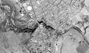
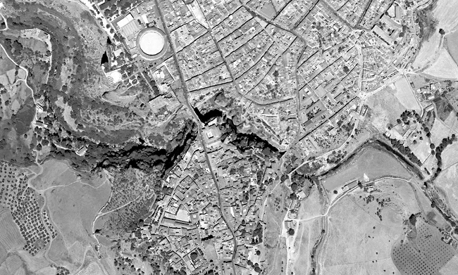
Ortofotografía Andalucía 2001-02
Ortofoto de Andalucía generada a partir de 25012 fotogramas escaneados a 14 micras con un tamaño de pixel de 0.28m. Ortofotos georreferenciadas en ETRS89 huso 30, correspondientes al territorio andaluz del Vuelo Fotogramétrico BN realizado entre 2001-02 a escala 1:20.000 sobre todo el ámbito nacional. (V007_of)
Simple
- Date (Creation)
- 2001-01-01
- Date (Revision)
- 2008-02-29
- Presentation form
- Digital image
- Purpose
-
Disponibilidad de Bases Cartográficas de Referencia en la Comunidad Autónoma de Andalucía, fruto del acuerdo de colaboración de 2002 entre las Consejerías de Obras Públicas y Transporte, Agricultura y Pesca y Medio Ambiente de la Junta de Andalucía.
- Status
- Completed
- Point of contact
-
Organisation name Individual name Electronic mail address Role Consejería de Medio Ambiente y Ordenación del Territorio. Junta de Andalucía
Author
- Theme
-
-
Fotografía aérea
-
Fotogrametría
-
Vuelo de bajo nivel
-
IDEAndalucia
-
Opendata
-
-
GEMET - INSPIRE themes, version 1.0
-
-
Ortoimágenes
-
- Access constraints
- Other restrictions
- Use constraints
- Other restrictions
- Other constraints
-
Creative Commons Attribution 4.0 International Public License (CC BY 4.0)
- Spatial representation type
- Grid
- Language
- Spanish; Castilian
- Character set
- UTF8
- Topic category
-
- Imagery base maps earth cover
))
- Supplemental Information
-
01020101
- Reference system identifier
- EPSG:25830
- Reference system identifier
- INSPIRE RS registry / http://www.opengis.net/def/crs/EPSG/0/4258
- Distribution format
-
Name Version JP2
ESRI Shapefile
1.0
- Units of distribution
-
Servicio WMS
- OnLine resource
-
Protocol Linkage Name OGC:WMS-1.1.1-http-get-map
http://www.ideandalucia.es/wms/ortofoto2001 IDEAndalucia Ortofoto 2001-02
- Units of distribution
-
Datos en descarga
- OnLine resource
-
Protocol Linkage Name WWW:LINK-1.0-http--related
http://descargasrediam.cica.es/repo/s/RUR?path=%2F01_CARACTERIZACION_TERRITORIO%2F02_BASES_REF_ORTOFOTOS_ORTOIMAGENES%2F01_ORTOFOTOS%2F01_PROYECTOS_REGIONALES%2F2001_02_AND_0.5m_V007_of Descarga Ortofotografía Andalucía 2001-02 (2001_02_AND_0.5m_V007_of)
- Hierarchy level
- Dataset
Conformance result
- Date (Publication)
- 2010-12-08
Citation identifier
- Explanation
-
Consultar el reglamento mencionado
- Pass
- Yes
- Statement
-
Para generar la ortofotografía se utiliza la información proporcionada por el vuelo fotogramétrico, el apoyo de campo, la aerotriangulación y el modelo digital de elevaciones.
- Description
-
Vuelo fotogramétrico analógico a partir de la escala 1:20.000 del año 2001-2002 en BN de la Consejería de Medio Ambiente.
Metadata
- File identifier
- 73e265ec-5797-4827-a803-2dc078b2f95a XML
- Metadata language
- Spanish; Castilian
- Character set
- UTF8
- Hierarchy level
- Dataset
- Date stamp
- 2022-09-01T12:05:16
- Metadata standard name
-
ISO 19115 "NEM"
- Metadata standard version
-
2003 "1.0"
- Metadata author
-
Organisation name Individual name Electronic mail address Role Consejería de Sostenibilidad, Medio Ambiente y Economía Azul. Junta de Andalucía
Author
Overviews
Spatial extent
Provided by
