 Catálogo IDEAndalucia
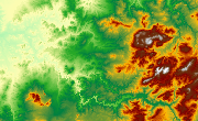
Localización geográfica de MDE de ámbitos locales de Andalucía.
Localización geográfica de los MDE disponibles en la REDIAM, obtenidos principalmente a partir de vuelos fotogramétricos y/o LiDAR de ámbitos locales. Delimitaciones de ámbitos cubiertor con MDE en formato vectorial y en el sistema de referencia ETRS89. (032V_el)
Simple
- Date (Creation)
- 2013-06-05
- Citation identifier
- Sin identificador
- Presentation form
- Digital map
- Purpose
-
Disponibilidad de un wms para la visión global de los datos referentes a MDT que están almacenados. Derivados de los proyectos fotogramétricos y LiDAR.
- Status
- Historical archive
- Point of contact
-
Organisation name Individual name Electronic mail address Role Consejería de Medio Ambiente y Ordenación del Territorio. Junta de Andalucía
Author
-
Observación del Territorio
-
-
Observación del Territorio. Producto primario
-
- Theme
-
-
Proyección cartográfica
-
IDEAndalucia
-
-
GEMET - INSPIRE themes, version 1.0
-
-
Elevaciones
-
-
Registro de temas REDIAM
-
-
Teledetección y caracterización del territorio
-
- Use limitation
-
Para saber la licencia hay que mirar el campo de acceso y uso.
- Access constraints
- Other restrictions
- Use constraints
- Other restrictions
- Spatial representation type
- Vector
- Denominator
- 1000
- Language
- Spanish; Castilian
- Character set
- UTF8
- Topic category
-
- Boundaries
- Elevation
- Imagery base maps earth cover
))
- Supplemental Information
-
01070102
- Reference system identifier
- EPSG:25830
- Reference system identifier
- INSPIRE RS registry / http://www.opengis.net/def/crs/EPSG/0/4258
- Distribution format
-
Name Version Shape
- Units of distribution
-
Servicio WMS
- OnLine resource
-
Protocol Linkage Name WWW:LINK-1.0-http--related
http://www.juntadeandalucia.es/medioambiente/mapwms/REDIAM_Delimitacion_Local_MDE? WMS Localización geográfica de Modelos Digitales de Elevaciones (MDE) de ámbito local
- Units of distribution
-
Ficha WMS
- OnLine resource
-
Protocol Linkage Name WWW:LINK-1.0-http--related
http://www.juntadeandalucia.es/medioambiente/site/rediam/menuitem.04dc44281e5d53cf8ca78ca731525ea0/?vgnextoid=e815d5388f604410VgnVCM2000000624e50aRCRD&vgnextchannel=33be7c119370f210VgnVCM2000000624e50aRCRD&vgnextfmt=rediam&lr=lang_es Ficha WMS Localización geográfica de Modelos Digitales de Elevaciones (MDE) de ámbito local
- Units of distribution
-
Datos en descarga
- OnLine resource
-
Protocol Linkage Name WWW:LINK-1.0-http--link
https://portalrediam.cica.es/descargas?path=%2F01_CARACTERIZACION_TERRITORIO%2F07_BASES_REF_ELEV%2F01_ELEVACIONES%2F02_PROYECTOS_LOCALES%2FDelimitacion_MDT_032V_el Descarga Localización geográfica de MDE de ámbitos locales de Andalucía.
- Hierarchy level
- Dataset
Conformance result
- Date (Publication)
- 2010-12-08
Citation identifier
- Explanation
-
Consultar el reglamento mencionado
- Pass
- Yes
- Statement
-
La capa de información vectorial en formato shape está revisada y no tiene errores topológicos.
Metadata
- File identifier
- 6f112239-36cb-4964-8629-f76d89c8b5dd XML
- Metadata language
- Spanish; Castilian
- Character set
- UTF8
- Hierarchy level
- Dataset
- Date stamp
- 2022-10-20T10:40:04
- Metadata standard name
-
ISO 19115 "NEM"
- Metadata standard version
-
2003 "1.0"
- Metadata author
-
Organisation name Individual name Electronic mail address Role Consejería de Sostenibilidad y Medio Ambiente. Junta de Andalucía
Author
Overviews
Spatial extent
Provided by
